The site of Balmuildy fort lies on a small plateau overlooking the river Kelvin.
Nothing of the fort is visible on the ground today, but traces of the ditch and outer mound are visible in the field east of the farm buildings on the north side of Balmuildy road.
Pre-dating the building of the wall, Balmuildy was one of only two forts on the Antonine Wall which had stone ramparts, rather than turf. Excavations have revealed a number of buildings, including the headquarters, two granaries, the commanding officer’s house, barracks and other workshop buildings. Inscriptions found on site reveal that the fort was constructed and probably garrisoned by soldiers of the Second Legion. A building inscription was found here, featuring the name of Lollius Urbicus, the general and governor of Britain who was responsible for the construction of the Antonine Wall.
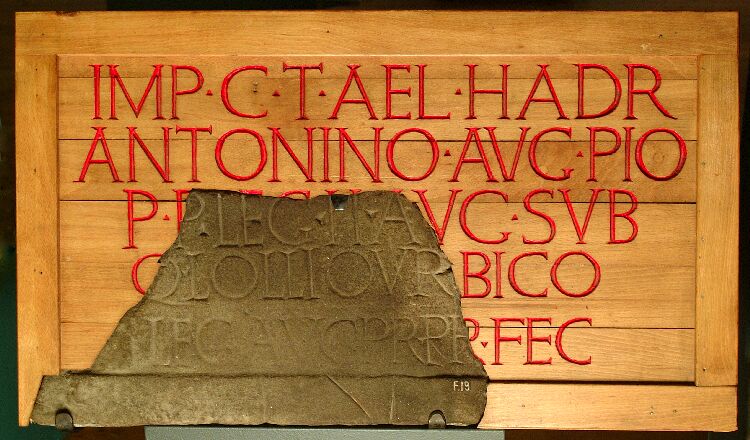
© Hunterian Museum
Other finds include small leather shoes – perhaps evidence for the presence of women and children. The site lies within the corner formed by the River Kelvin, Balmore Road (A879), and Balmuildy Road—between Easter Balmuildy Farm and the sewage works.
What's Nearby

Click on the links below to find out about the site's nearest accommodation, attractions and food & drink facilities.